Regional Municipality of York Pedestrian and Cycling Intersection Safety Pilot Project
York, ON, Canada
Data-driven study for road safety
The Regional Municipality of York’s Pedestrian and Cycling Intersection Safety Pilot Project provided a data-driven study of vulnerable road users’ safety along its roadway network.
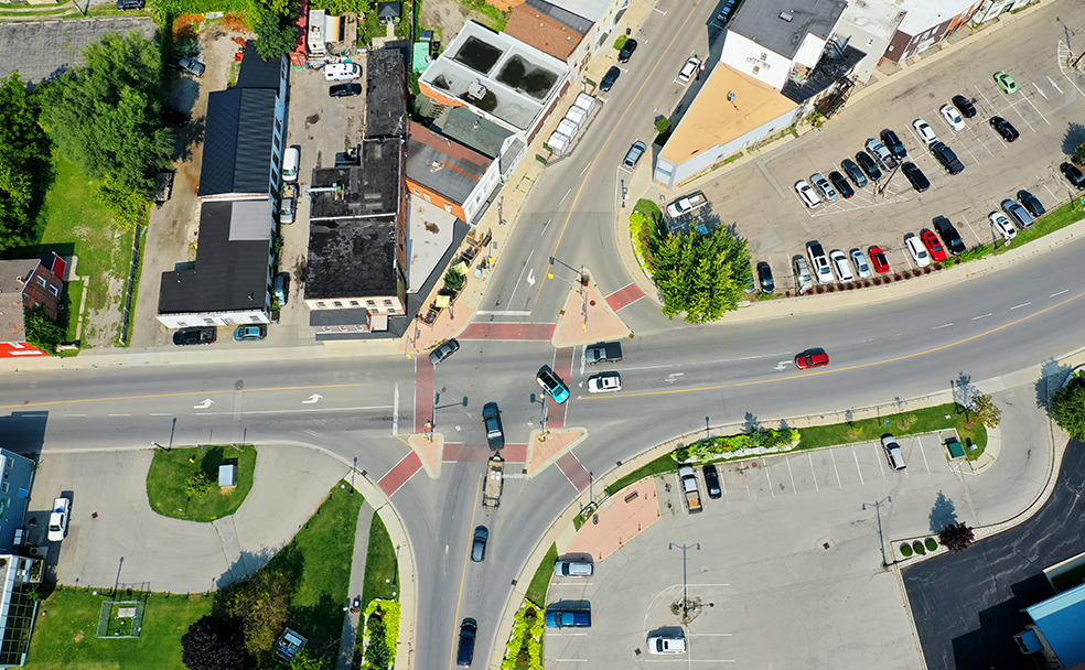
York Region is one of Canada’s largest municipalities and its regional road network consists of urban rapid transit corridors, suburban arterials, rural roads and main streets. The road network has approximately 4,200 lane kilometers that connect travelers to communities, provincial highways, rapid transit, trains, buses, a subway terminal and walking and cycling facilities. The York Region continues to become more urbanized. To create future-focused safety improvements for the region, EXP conducted an analysis of 10 years of collision to distinguish geospatial and statistical and features of collisions involving cyclists or pedestrians to create future-focused safety improvements, with a comprehensive study for the York region between 2018-2021.
This important project is an example of how collaboration yields improvements for communities. Through coordinated efforts with stakeholders, including York Regional Police, York Region Public Health, Ministry of Transportation of Ontario and local municipalities, York Region’s intersection safety pilot project helped decrease traffic conflicts by up to 100% and collisions by more than 60% at these intersections.
EXP reviewed the past 10 years of pedestrian and cyclist collisions data, totaling 1,462 pedestrian and 883 cyclist collisions. While the study provided critical information about the characteristics of the crash, it didn’t provide information on why collisions are occurring or where to focus specific countermeasure efforts. Therefore, an extensive geospatial analysis was conducted using GIS software and over 100 geographic information system (GIS) layers, including the presence of sidewalks and separated cycling facilities; location of bus stops, schools and hospitals; population density and traffic volumes.
The study delved into conflict data and analysis based on sophisticated video analytics and reviewed best practices for pedestrian and cyclist safety across North America. A suite of potential safety countermeasures was identified, reviewed and evaluated. The study also identified priority locations using the National Cooperative Highway Research Report (NCHRR) 803 Study approach in the selection of the locations. It included a pilot program with a suite of operational measures proven to prevent collisions and change driver behavior.
Four key countermeasures were implemented at four pilot intersections in 2019 to reduce injury collisions between turning vehicles and pedestrians or cyclists:
- Right-turn-on-red prohibitions
- Protected left-turn movements
- Leading pedestrian intervals
- Warning signage
The performance of the safety improvements was measured over one year and continued to be monitored and evaluated, and a year-long monitoring program confirmed a 90% reduction in observed vehicle-pedestrian conflicts and a 66% reduction in injury collisions. The operational measures expanded to more intersections throughout 2022 and 2023. In addition, the information supported more informed decision-making for the York Region.
Services
Transportation Planning