Île d’Orléans Iconic Bridge
Quebec City and Île d'Orléans, QC, Canada
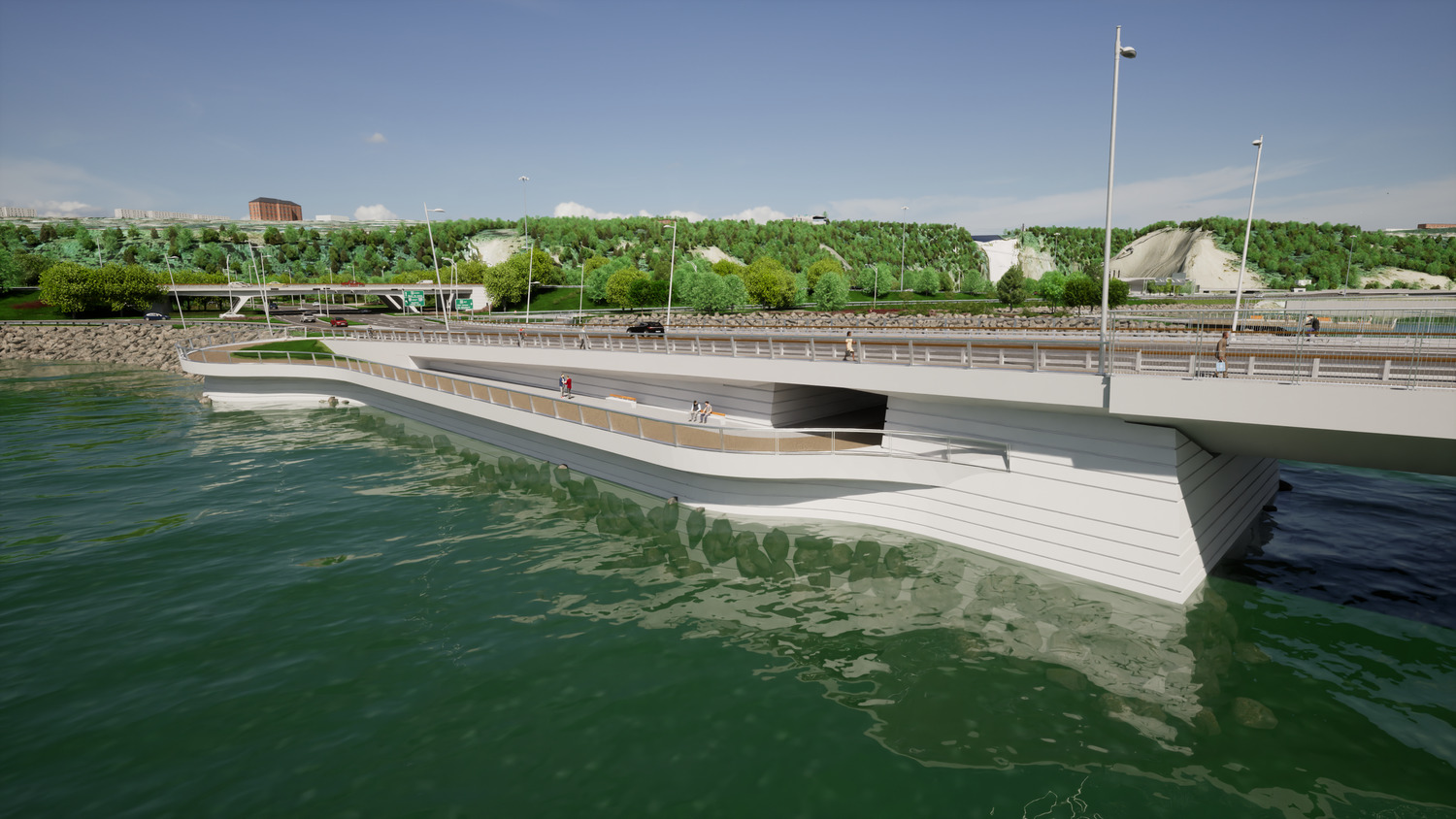
Creating a signature, sustainable bridge for a region steeped in history
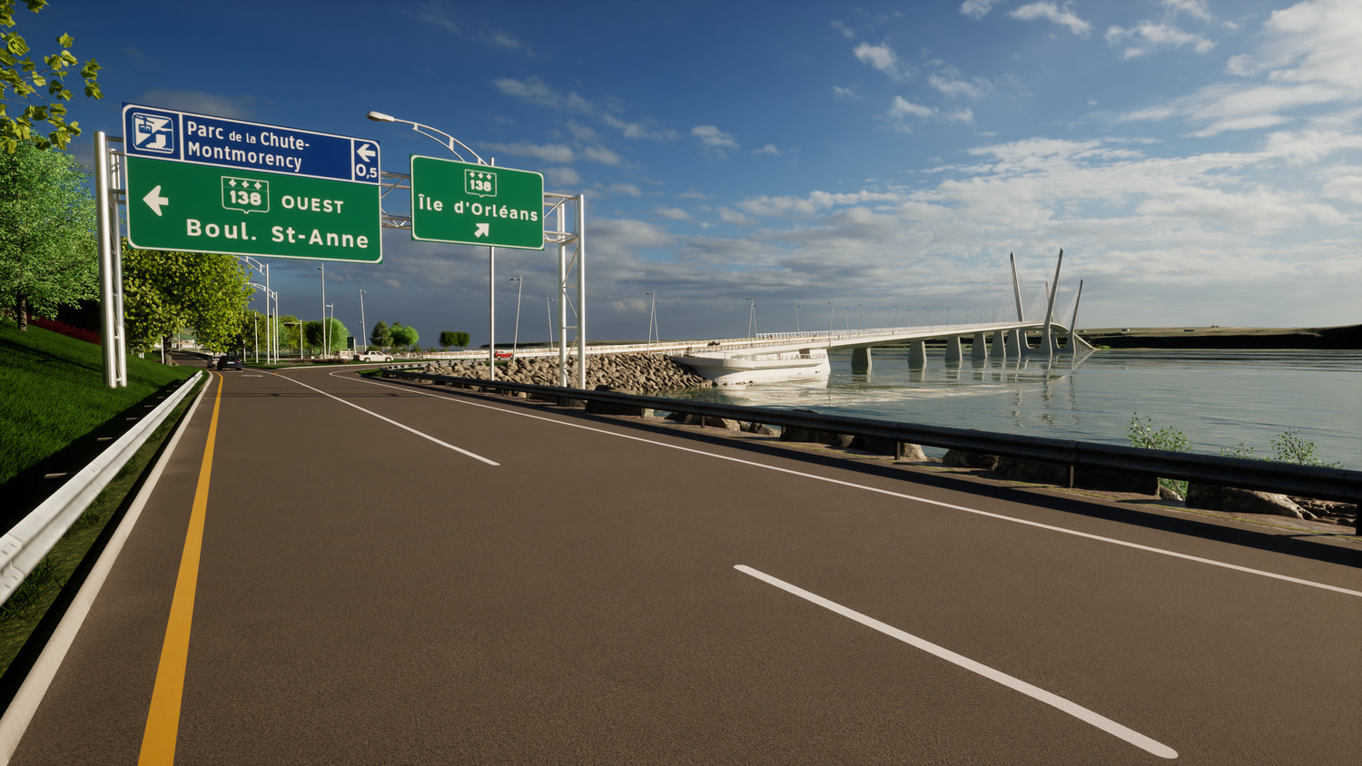
Located just off the north shore of the St. Lawrence River, near the city of Quebec, Île d’Orléans is a 193 km2 island that is home to close to 8,000 people and a major tourist destination in the summer. It is connected to the mainland by a single bridge built in 1935 that does not meet current requirements.
To replace the existing bridge, the Quebec Ministry of Transportation wanted an elegant, balanced and sleek structure to showcase the region’s natural, cultural and historical landscape, and would be able to withstand the effects of climate change. After being selected by the Ministry to conduct the definitive pre-project study, Groupement Origine Orléans – a consortium made up of EXP and other engineering firms – incorporated all those elements into the new Île d’Orléans bridge’s design.
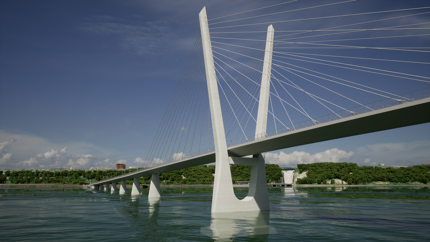
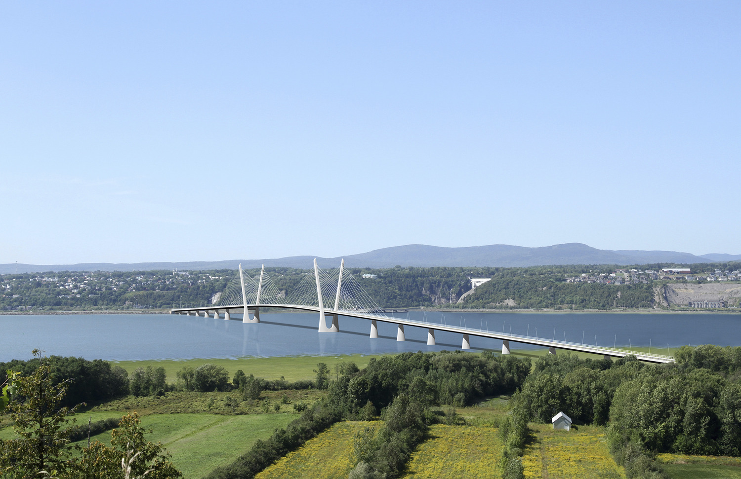
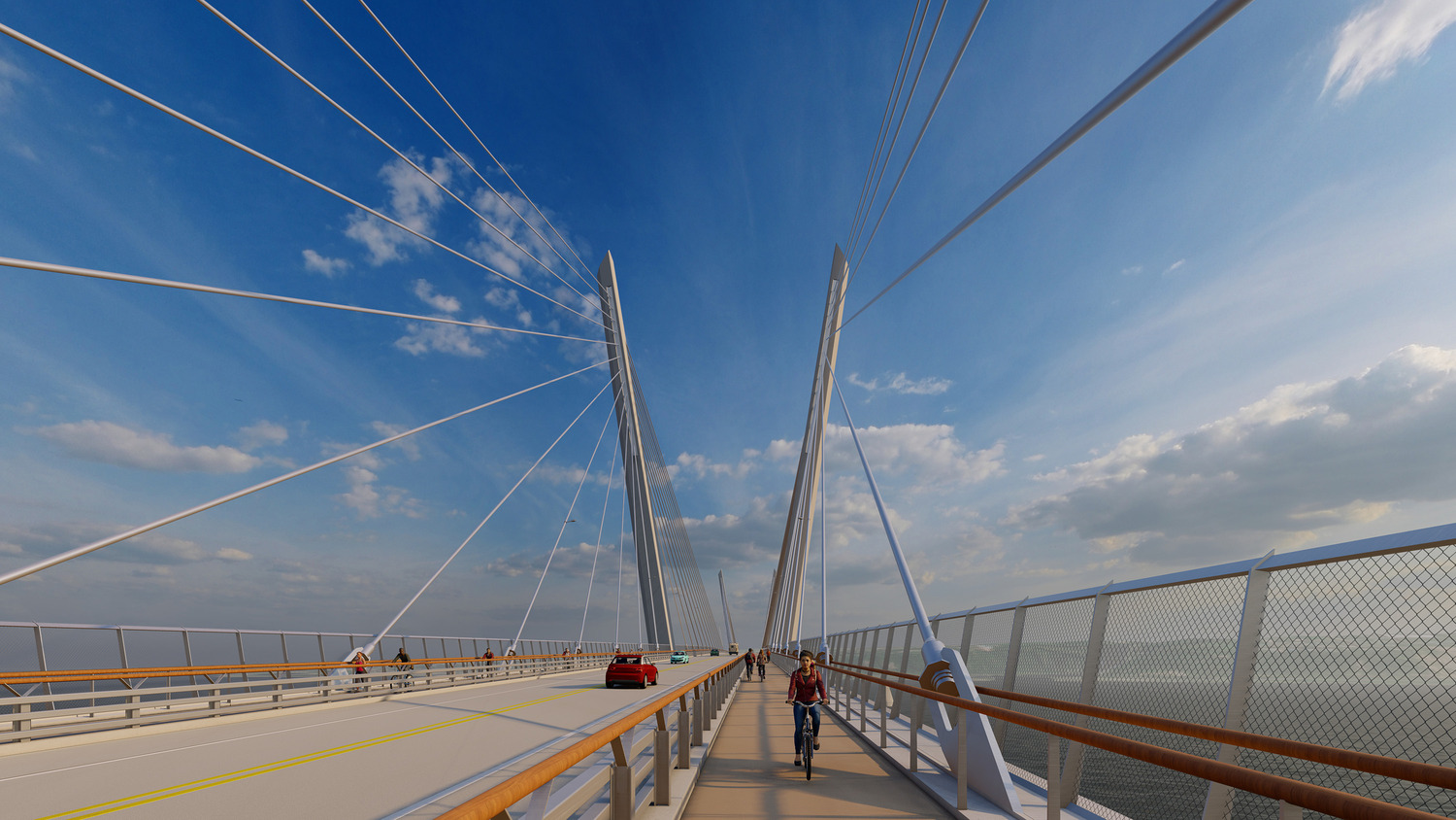
The new 2.1 km cable-stayed bridge will be built to the west of the current structure and will include wider traffic lanes – one in each direction – shoulders and a multi-use path for pedestrians and cyclists along both lanes.
The architectural design of the new bridge is reminiscent of the maritime history of Île d’Orléans and is intended to showcase the river and the natural landscape of the site. It is also designed to adapt the crossing experience to the user and promote active transportation between the two shores. In addition to offering new views of Île d’Orléans, Quebec City and the Montmorency Falls, the bridge will be illuminated at night to display the elegant cable-stayed structure.
The longevity of a structure depends on multiple factors, including careful engineering design and the use of materials that are durable, low-maintenance and suited to weather conditions. To design this bridge, climate forecasts for the coming century were taken into account. Experts drew on past data to predict future trends and find solutions to current and future challenges brought on by climate change.
Projected changes to freeze-thaw cycles and the gradual scouring of marine soil are some of the factors that were evaluated. Since changes to freeze-thaw cycles will result in rising water levels in this area and the expansion of the floodplain, the project would involve raising the road leading to the bridge. The anticipated scour of the riverbed, at a depth of about 49 feet over the next 100 years, would also lead to changes to the conditions and loads to which the foundation and support elements of the bridge’s structure will be exposed. These elements were designed to preserve their integrity and weather these changes and the passage of time.
EXP’s team designed a digital 3D model of the structure using integrated drone imagery and virtual reality.
Services
Pavement, Traffic, Lighting Design, Sustainable Development, Drainage, UAV/Drone Services, Civil, Electrical, Sustainable Mobility, 3D Modeling, Structure Monitoring, Bridge Design