Port Lands Flood Protection and Enabling Infrastructure
Toronto, ON, Canada
Supporting one of the largest civil engineering initiatives in North America
The Port Lands Flood Protection and Enabling Infrastructure project (PLFPEI) is a comprehensive plan for flood protecting southeastern portions of downtown Toronto.
This includes parts of the Port Lands, South Riverdale, Leslieville, south of Eastern Avenue, Atlas Crane, Cherry Street and bridges, Don Roadway, Keating Channel, Ship Channel, future Polson, and the First Gulf/Unilever development site. All are at risk of flooding under a provincially defined regulatory storm event.
Critical geotechnical instrumentation
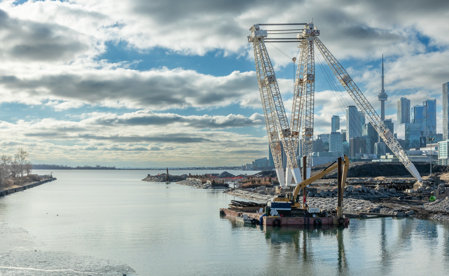
EXP was hired to provide geotechnical monitoring services for the removal of the West Plug. The West Plug, located at the mouth of the Don River under the Cherry Street South bridge, has served as a barrier, separating the newly constructed river channel from Lake Ontario. Its removal marks a major milestone, allowing the re-naturalized Don River to flow freely into Lake Ontario for the first time, representing a significant achievement in both environmental restoration and engineering.
Over 1460 instruments were used to complete this project. These included: vibrating wire piezometers, inclinometers, structural settlement markers, settlement plates, settlement rods, deep settlement rods, tiltmeter, dock wall monitoring points, in-place inclinometer, settlement makers, vibration monitor and deep-seated benchmarks.
Revitalizing a once-derelict industrial area
This flood protection project, one of the largest civil engineering initiatives in North America, is a foundation of the broader plan to revitalize the area into a new island community, supporting sustainable urban growth in downtown Toronto while addressing the city’s increasing housing demands. For decades, the Port Lands remained derelict due to its polluted industrial history. Converting the area into green space with flood-absorbing wetlands has made the floodplain viable for development.
This project is setting the stage for what will be the biggest transformation to the Toronto waterfront.
Services
Geotechnical Monitoring