By: Andrew Holford, P.Eng., Discipline Manager | EXP
Light Detection and Ranging (LiDAR) technology is an advanced method of collecting, processing and analyzing data. This accurate technology is equipped with high precision GPS and collects millions of points of data per second and transforms them into a model, resulting in a digital twin of a real-world site.
LiDAR technology goes beyond simple surveying and can be used for a wide variety of services such as topography mapping and digital terrain modeling (DTM), precondition audits, floodplain mapping, measuring soil stockpiles, final as-built conditions and stability monitoring. With the adoption of this technology and its advanced functions, mapping and monitoring have now become a requirement in almost every major construction project.
Completing projects with enhanced efficiency
The use of LiDAR technology allows our geotechnical and infrastructure experts to harvest more accurate and continuous data to complete projects more efficiently. Project sites must be surveyed to understand their characteristics, identify potential hazards and plan for construction. Due to the accuracy of the data a single survey can produce a permanent record of the initial project site conditions. Additionally, with the breadth and continuity of the mapping, the initial survey only needs to be conducted once to capture all of the site information. The model can then be used to obtain any additional information needed, removing the need for costly follow-up site surveys due to missing data or inaccessible areas.
LiDAR technology helps to identify issues and risks that cannot be seen with the eye alone, which prevents costly issues in the long run. Following construction, these models also help project teams ensure that the outcome matches the design. For our clients, EXP’s LiDAR services have become the most cost-effective insurance they can buy for their project.
Leading with in-house expertise
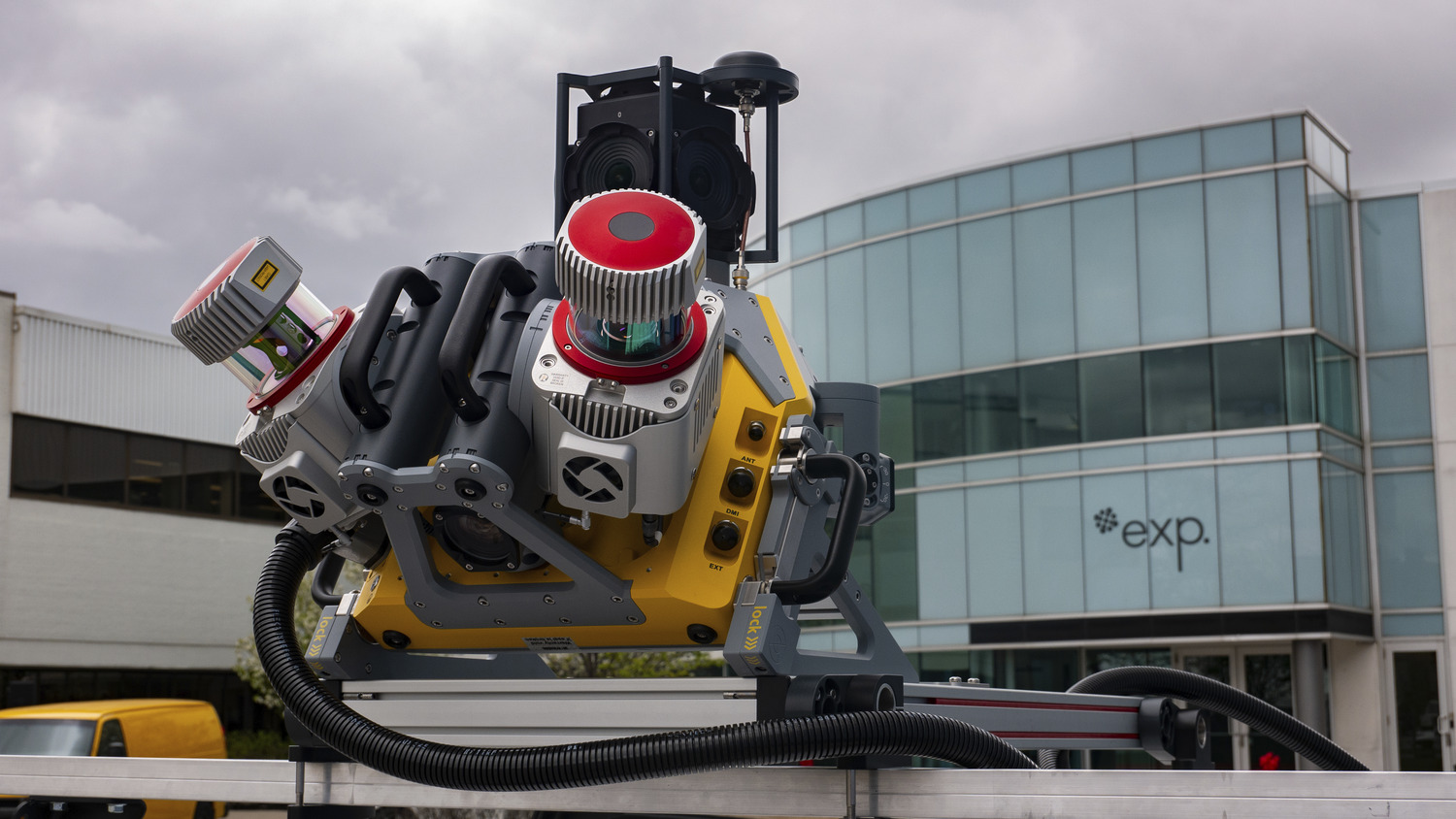
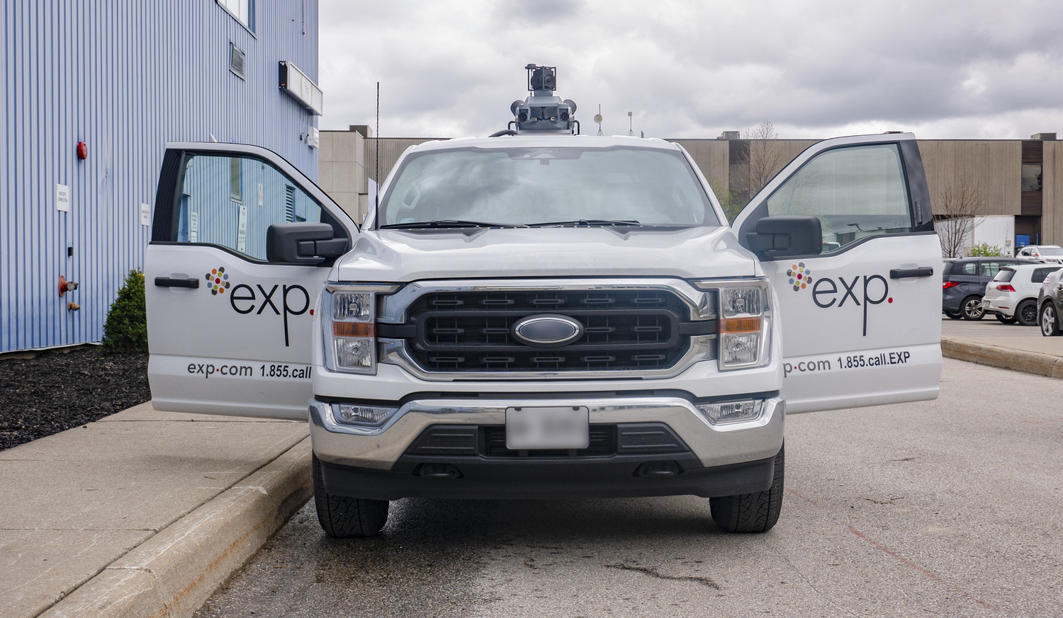
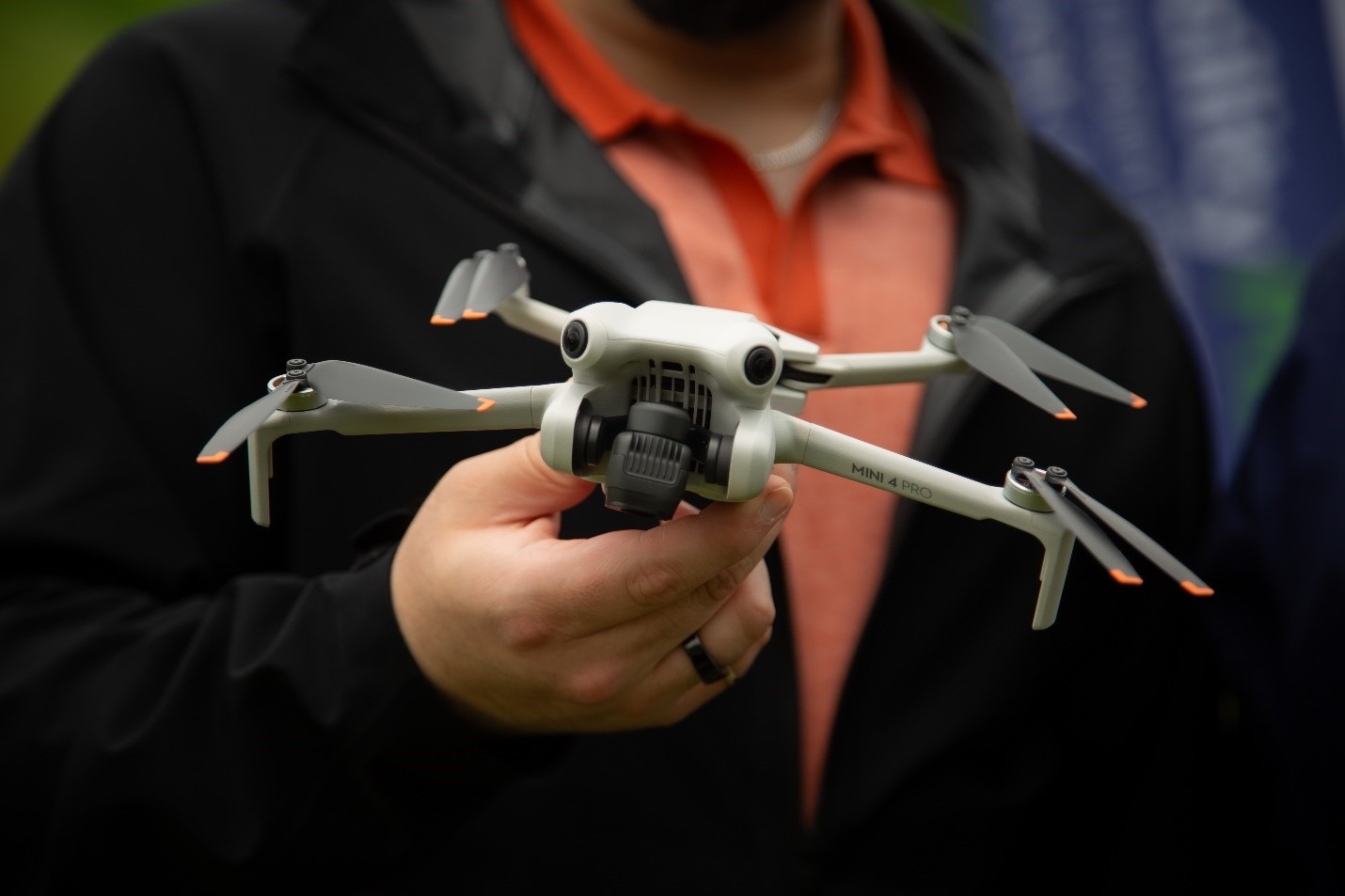
LiDAR technology comes in an array of forms. EXP utilizes several forms including terrestrial LiDAR situated on a tripod, LiDAR that can be mounted on a drone and flown around a site, a mobile mapping system mounted on a truck that can be driven around a site and handheld LiDAR systems. These systems can be transported between offices and project sites, and the models produced can be shared remotely, making collaboration across locations simple.
With a team dedicated to LiDAR and geomatics, and some of the most advanced hardware and software in the industry, EXP is at the forefront with the application of this technology. Because we have this expertise and equipment in-house, we are able to provide custom solutions for specific project requirements, and do so more efficiently and effectively.
LiDAR is used in many projects to prepare construction sites. In one example, EXP conducted a precondition audit of a future building site for a client to identify natural and manmade features that could affect the construction and project planning. Using our drone-based LiDAR we produced 3D maps of the site including geo-referenced scaled imagery of the area. Following this, the team was able to conduct a topographical survey with the data. This data can be further leveraged for multiple deliverables including cut/fill requirements, site drainage, clearance measurement to existing features and site infrastructure, asset management and more, all without the need to re-attend the site.
LiDAR is no longer a “nice to have” technology, it is the way of the future for major construction projects, and EXP has been at the forefront of this advancement. Equipped with this technology and our project teams’ expertise, EXP will continue to utilize LiDAR to help our clients achieve their goals.
Learn more about EXP’s digital expertise and how we help clients anticipate the future with monitoring services.